2012-12-19

Tudományos ismeretek feltárásának jövője nyílt hálózatok környezetében

Paul F. Uhlir at the 23rd CODATA Conference in Taipei. Photo: HUNAGI, 2012


Mai postánkból. Az ICSU CODATA csatornán érkezett:
"Dear Colleagues: 
 On behalf of the National Research Council, I am pleased to transmit to you the report:  The Future of Scientific Knowledge Discovery in Open Networked Environments: A National Workshop. It is available freely at: http://www.nap.edu/catalog.php?record_id=18258 on the websites of the National Academies Press and the Board on Research Data and Information (BRDI).
BRDI held a national workshop on this topic in Washington, DC on 10-11 March 2011 to bring together key stakeholders in this area for intensive and structured discussions. The meeting explored options to obtain and promote a better understanding of the computer-mediated scientific knowledge discovery processes and mechanisms for openly available data and information online across the scientific domains. The workshop resulted in a report that synthesizes the contributions of the experts, and presents an authoritative and high-level review of the most promising and effective research opportunities in this area.
Copies of the report may be ordered through the National Academy Press (http://www.nap.edu). Please feel free to re-disseminate this information to your contacts.
                                                                           Sincerely yours,
                                                                           Paul F. Uhlir
                                                                           Director,
                                                                           Board on Research Data and Information"

2012-06-15

Kutatási célú robotrepülőgépes adatgyűjtés viharfelhőzetben

A Tolna megyei viharkárok ráirányítják a figyelmet a robotrepülőgépes légitávérzékeléssel kapcsolatos kutatás-fejlesztésre.  A robotrepülőgép és a komplex sokérzékelős távérzékelési rendszerek viharzónák felhőzete vizsgálatára történő felhasználása hozzájárulhat a szupercellák kialakulásának jobb megértéséhez, a védekezés hatékonyságának növeléséhez. A NASA Echo rendszeréből hozzáférhetőek az ACES projekt mérési adatai is. A WGISS munkacsoportjától érkezett mai hír leírja az ACES projekt lényegét:
ALTUS Cloud Electrification Study (ACES) was Based at the Naval Air
Facility Key West in Florida. ACES researchers in August 2002 conducted overflights of thunderstorms over the southwestern corner of Florida. For the first time in NASA research an uninhabited aerial vehicle (UAV) named ALTUS was used to collect cloud electrification data. Carrying field mills, optical sensors, electric field sensors and other instruments, it allowed scientists to collect cloud electrification data for the first time from above the storm from it's birth through dissipation. This experiment allowed scientists to achieve the dual goals of gathering weather data safely, and testing new aircraft technology. This dataset consists of data collected from seven instruments: the Slow/Fast antenna, Electric Field Mill, Dual Optical Pulse Sensor, Searchcoil magnetometer, Accelerometers, Gerdien Conductivity Prove, and the Fluxgate Magnetometer. Data consists of  sensor reads at 50HZ throughout the flight from all 64 channels." Ha érdeklik a hozzáférés részletei, írjon: hunagi@hunagi.hu

2012-02-29

EuroSDR e-learning tanfolyamok 2012 márciustól. Most jelentkezzen!

Mai postánkból.: 

"Dear Colleagues
Please register now for the 2012 series of elearning courses offered by EuroSDR from March 2012.
The courses:
Terrestrial Reference Frames: application to the realisation of the European Reference System (ETRS89)
Hosted by: Ecole Nationale des Sciences Géographiques, Paris.
3D data in Urban Environments
Hosted by: IGN France
Open Standards & Open Source WebMapping
Hosted by: ITC University of Twente, Netherlands
Radiometric performance of Digital Photogrammetric Cameras and Laser Scanners
Hosted by: Finnish Geodetic Institute and TU Vienna
Preparations are well underway for this 2012 series of short distance e-learning courses from EuroSDR. They will begin with a two-day pre-course seminar, hosted by the Dublin Institute of Technology (DIT), Bolton Street, Dublin, Ireland from 12th to 13th March 2012.
For further details, please check the webpages:
EuroSDR secretariat
Public Management Institute - Catholic University of Leuven
Parkstraat 45 bus 3609 – 3000 Leuven, BELGIUM
Látogatásra ajánlott honlapok:
AGILE: www.agile-online.org EuroSDR: www.eurosdr.org 
Nemzeti Innovációs Hivatal: www.nkth.gov.hu

2011-04-21

A IJDE szerkesztőség kiválasztásábn: 10 cikk ingyenesen letölthető a Digitális Föld nemzetközi szakfolyóiratból!

Mai postánkból:
"Dear Colleagues,


I would like to draw your attention to the ten selected papers of the International Journal of Digital Earth (IJDE) below: 

Digital Earth: decadal experiences and some thoughts
H. D. Guo; Z. Liu; L. W. Zhu
Crowdsourcing geographic information for disaster response: a research frontier
Michael F. Goodchild; J. Alan Glennon
Digital Earth’s Nervous System for crisis events: real-time Sensor Web Enablement of Volunteered Geographic Information
Bertrand De Longueville; Alessandro Annoni; Sven Schade; Nicole Ostlaender; Ceri Whitmore
The application of open standards to enhance the interoperability of geoscience information
G. Percivall 
Selected issues of cartographic communication optimization for emergency centers
Karel Staněk; Lucie Friedmannová; Petr Kubíček; Milan Konečný 
The contribution of maps to the challenges of risk communication to the public
Doris Dransch; Henry Rotzoll; Kathrin Poser 
The Sensor Web: systems of sensor systems
T. L. van Zyl; I. Simonis; G. McFerren 
Metadata requirements analysis for the emerging Sensor Web
Liping Di; Karen L. Moe; Genong (Eugene) Yu 
Identifying damage caused by the 2008 Wenchuan earthquake from VHR remote sensing data
D. Ehrlich; H. D. Guo; K. Molch; J. W. Ma; M. Pesaresi  
A new global raster water mask at 250 m resolution
M. L. Carroll; J. R. Townshend; C. M. DiMiceli; P. Noojipady; R. A. Sohlberg 
 
As you know, IJDE has been indexed by SCI-E in 2009 and initially received an impact factor of 0.864 for the year of 2009. These ten papers were selected for free download in 2011. You are strongly encouraged to download and cite them in your research papers.
Please click the links of each paper in the attached pdf document to access.
It would be great if you can circulate this message around your colleagues.
Best wishes,
Editorial Office, International Journal of Digital Earth
(The Official Journal of the International Society for Digital Earth)
                                                                
No. 9 Dengzhuangnan Rd., Haidian District 
Beijing 100094, China    
Tel: 86-10-82178902 Fax:86-10-82178916
IJDE Paper Online Submission: http://mc.manuscriptcentral.com/ijde"

2011-02-08

25 éves az IJGIS folyóírat

Az International Journal of Geographic Information Science folyóírat ünnepi, jubileumi száma teljes tartalmával szabadon letölthető. Klikk a címsorra!

2010-08-27

Új Széchenyi Terv vitairat

Kép forrása: www.ngm.gov.hu 
Tagszervezeteink, tagintézményeink és partnereink figyelem! 
Új Széchenyi Terv vitairat véleményezés lehetősége.
A beérkezett véleményeket HUNAGI kész összegyűjtve  továbbítani.
A dokumentum a címsorra klikkelve érhető el.

2010-04-28

Cikkeket várnak "data-intensive geospatial computing" témakörben


Mai postánkból. Ludo Engelen továbbította az alábbi figyelemfelhívást a Leuveni Katolikus Egyetemről:
"Call for Papers
A special issue on data-intensive geospatial computing with International Journal of Geographical Information Science

Data-intensive computing has been emerging as a fourth scientific paradigm from the mainstream computer science. In terms of the techniques and technologies involved, this fourth paradigm is fundamentally distinct from the third one called computational science focusing on simulating complex phenomena or processes since the invention of computers. The massive data volume and ever increasing computing power in the twenty-first century will dramatically change the ways of doing science and scholarly communications. We believe therefore that this emerging new paradigm has profound implications to geographic information science and various applications to environment and urban systems. CyberGIS is an emerging phenomenon where geographic information systems or science (GIS) meets cyberinfrastructure for data-intensive geospatial computing. Many unsolvable problems with environmental and urban systems can be well studied using the continuously increasing geospatial data, collected through massively deployed positioning technologies, sensor networks and voluntary contributions by individuals, and ever increasing computing power of personal computers, higher performance computers, and emerging grid/cloud computing facilities. This special issue of International Journal of Geographical Information Science is seeking original unpublished papers that describe recent advances and efforts in data-intensive geospatial computing, with particular applications to environment and urban systems.

Suggested topics include (but are not limited to):
•           Intensively computing volunteered geographic information for geographic knowledge discovery
•           Grid/cloud computing geographic data for unsolvable or hard-to-solve GIS problems
•           Massive agent-based simulation of nonlinear geographic phenomena and processes
•           Analyzing large-scale geosensor networks data for monitoring environment and urban systems
•           Deployment and development of web mapping processing services for various applications

Submission:
All manuscripts including any support material should be submitted using the journal's online Manuscript Central facility (http://mc.manuscriptcentral.com/ijgis). We encourage authors to consider this option of support materials archiving of data and video clips, which is a distinguished feature of this special issue. Authors must select “Special Issue” while they reach the “Article Type” step in the submission process, and identify the “data-intensive geospatial computing” special issue in their cover letter. First-time users must register themselves as Author.

Important dates:
Paper submission due: 30 September 2010
Acceptance notification: 31 January 2010
Publication of the issue: 30 April 2011

Guest editor:
Bin Jiang, Department of Technology and Built Environment, University of Gävle, Sweden
-------------------------------------------------------------------------------------------------------------------------------------------
-------------------------------------------------------------------------
Ludo Engelen
SADL, K.U.Leuven
(Spatial Applications Division Leuven)
Celestijnenlaan 200 E
B-3001 Leuven, Belgium
Tel: +32 -16-32 97 32 Fax: 032-16-32 97 24 ludo.engelen@sadl.kuleuven.be 
http://www.sadl.kuleuven.be


2010-03-29

Publikációs lehetőség regionális politika, területfejlesztés és infokommunikációs témakörökben

A HUNAGI főtitkár minapi postájából egy levél, amely a regionális politikában, a kapcsolódó kutatás-fejlesztésben és infokommunikációs megoldásokban jártas elméleti és gyakorlati szakemberek számára szól:
"Kedves Kolléga!
A Budapesti Corvinus Egyetem Gazdaságföldrajz Tanszékén a kutatási-oktatási profil átrendezésének keretében egy negyedéves, on-line, magyar-angol nyelvű szakfolyóiratot indítunk Corvinus Regional Studies / Corvinus Regionális Tanulmányok címmel. Arra kérném, hogy amennyiben ideje, energiája engedi, Ön vagy valamelyik munkatársa küldjön be regionális politikával, fejlesztéssel, az infokommunikációs technológia és a web területfejlesztési szerepével kapcsolatos tanulmányt az új folyóiratnak, melynek a linkjét megpróbáljuk minél szélesebb körben itthon és külföldön terjeszteni.
A folyóirat élesben 2010 április közepétől indul a www.uni-corvinus.hu/crt linken. Addig is a tervezete megtekinthető a http://highlight.hu/crt/ linken. A megjelenésre szánt kéziratot lehet a technikai szerkesztőnek küldeni a jtgergo@gmail.com címre.
A kritériumok: A kézirat 4-8 oldal közötti terjedelmű legyen szokásos 12-es betűmérettel másfeles sortávval, 2,5-es margóval. Angolul és magyarul egyaránt be kellene küldeni. Minden kézirathoz szükséges egy pár mondatos ajánlás a szakterület egy-egy, a szakirodalomból már ismert képviselőjétől (hacsak a szerző maga nem PhD vagy DSc) miszerint nevezett írást megjelenésre javasolja a Corvinus Regionális Tanulmányokban. Az angol szöveget a szerző nyelvi szempontból lektoráltassa. Ezen kívül minden szerző küldjön be a kézirattal együtt egy internetes megjelenésre általa jóváhagyott arcképet, e-mail címet, beosztás/munkahely ill. foglalkozás megnevezést. A tanulmány bármilyen ábrát tartalmazhat.
Kedves Kolléga, bízom benne, hogy a közeljövőben Ön, vagy valamelyik munkatársa, ismerőse az Ön ajánlására beküld az új folyóiratunk részére egy-egy írást regionális témában.
A legjobbakat kívánva, köszönettel és üdvözlettel
Prof. Dr. Tózsa István."

2010-02-26

Egyéves továbbképzés Toulouse-ban

Mai postánkból:
"ISAE is deeply involved in space sciences and applications and I am delighted to inform you that we are launching a new specialized master in Earth Remote Sensing and Observation Systems. This master is designed for professionals possessing a bachelor degree and at least 3 years of professional experience or to students with a master degree aiming at acquiring competencies in every stage of the image chain treatment for all application domains: Environmental issues (oceanography, sustainable development, forest and water management, etc.), Civil issues (GIS, Cartography, etc.) and Safety & Security.
I have attached the SM ERSOS leaflet for information
Should there is any more information you may require for you or any member of your organisation, please let me know....
Michel CHAUVIN
Deputy Director of masters programs
Marketing & recruitment
Institut Supérieur de l'Aéronautique et de l'Espace (ISAE)
10, avenue Edouard Belin - BP 54032 F-31055 Toulouse cedex 4
T: +33 5 61 33 80 27
Mobile: +33 673 289 534
www.isae.fr"
Jelentkezni hamarosan a címsorra kattintással lehetséges.
http://www.fomi.hu/hunagi/pdf/2004/SM-ERSOS.pdf
További hasznos linkek:
AGILE: www.agile-online.org
EuroSDR: www.eurosdr.org
NKTH: www.nkth.gov.hu

2009-11-03

Oktatási és tudományos célra hozzáférhető világméretű digitális magassági modell

Egyelőre prototípus szinten, SRTM és ASTER adatokra támaszkodó világméretű digitális magassági modell portált készített a George Mason Egyetem. Az adatokat az oktatói és kutatói szféra részére kívánják hozzáférhetővé és felhasználhatóvá tenni írta az intézet vezetője Liping Di tegnap a CEOS WGISS (http://wgiss.ceos.org) tagjai és partnerei számára. A HUNAGI A GSDI világszervezet összekötője a testületben.
Bővebbet a http://hunagi5.blogspot.com HUNAGI blogon.

2009-02-20

Kultúrális Atlasz Kezdeményezés Jelentése

Térinformatika, történelem, régészet
Az ECAI igazgatójának ma érkezett jelentése (HUNAGI és tagintézményei három fővel vannak képviselve a globális programban: ELTE TGT, NymE GK, MTA TTI, HUNAGI):
"ECAI Directors' Report
February 2009

FUTURE MEETINGS

ECAI Meetings with CAA, March 22-26, 2009, Williamsburg, Virginia
ECAI’s Spring 2009 Meeting will be held in conjunction with CAA (Computer Applications and Quantitative Methods in Archeology) on March 22-26, 2009, Williamsburg, VA, USA, with the theme “making history interactive.” The conference website: http://www.caa2009.org.


The Third International Conference on Remote Sensing in Archaeology, August 17-21, 2009, Tiruchirappalli, Tamil Nadu, India
The Third International Conference will be organized jointly by ECAI, Bharathidasan University, Tiruchirappalli, the University of California), Merced and Berkeley, theUniversity of Siena (Italy) and the REACH Foundation, Chennai. http://www.spacetimeplace2009.org

The conference will discuss a wide range of perspectives, approaches and issues on the use of remote sensing and digital technologies in documenting, analyzing and interpreting archaeological and anthropological contexts. Innovative contributions, case studies, research projects and posters are invited on Digital Cultural Atlases (projects and prototypes) and cultural atlas components (gazetteers, time-periods, biography and social networks, thesauri, technical infrastructure, content sources and display models) and many related topics.

Important date: Send Abstract (max 500 words) to cliuzza@ucmerced.edu by 28th, February, 2009.
See http://www.spacetimeplace2009.org for details.


NEW DEVELOPMENTS

ECAI Sanskrit Working Group (ESWG)
The ECAI Sanskrit Working Group (ESWG) was constituted in 2008, with a goal of increasing the quantity, uniformity, utility, and longevity of Sanskrit and other Indic texts on the Web. (For the detailed mission statement, see the ESWG web site http://www.ecai.org/sanskritworkinggroup/indexst.html) To date the ESWG has initiated two projects: creation of a test bed for developing
standards, tools, and technologies for the storage, retrieval, and analysis of Sanskrit and other Indic language documents; and development of a model for connecting distributed repositories of documents in Sanskrit and other languages.

A progress report on the first of these projects was delivered at the 2008 PNC/ECAI Conference in Hanoi, Vietnam. Powerpoint slides with presenter notes are available at
http://people.ischool.berkeley.edu/~rmoon/ValueProposition.pdf
and the test bed application itself can be found at http://metaphor.ischool.berkeley.edu:8080/SDR/. The Working Group is currently focusing on the second project and will present a progress
report in the second quarter of 2009.

Ralph Moon, Chair, ESWG, rmoon@berkeley.edu/

The International Journal of Humanities and Arts Computing (formerly Journal of History and Computing) is published by Edinburgh University Press with ECAI’s support. Vol 1, no. 2, recently issued, includes “Creating a landscape of memory: The potential of Humanities GIS,” by David J. Bodenhamer, “Fusing time and space: The Historical Information system HGIS Germany” by Andreas Kunz, and four other articles.
See http://www.eupjournals.com/journal/ijhac


ECAI CENTRAL ACTIVITIES

Michael Buckland presented a paper summarizing ECAI’s projects “Bringing Lives to Light: Biography in Context” < http://ecai.org/imls2006 > and “Context and Relationships: Ireland and Irish Studies” < http://ecai.org/neh2007 > at the School of Library and Infomation Science of the University of South Florida on Feb 3.

Lewis Lancaster has presented papers at:
- University of Auckland, New Zealand “Buddhist Texts and Digital Technology”
- University of the West, Los Angeles “Chinese Buddhist Studies”
- EFEO Workshop, Siem Reap, Cambodia “Digital Archive Strategies”
- TELDAP Conference, Academia Sinica, Taiwan “Archive as Event.”

Jeanette Zerneke gave a paper at the Workshop on Tools and Techniques for Understanding Historical Processes at the University of Richmond, Virginia.

Past ECAI Directors’ Reports are available at
http://ecai.org/about/directorsRpts.html "

További kutatási
More on AGILE: www.agile-online.org
More on EuroSDR: www.eurosdr.org
More on ECAI: http://ecai.org
More on NKTH: www.nkth.gov.hu

2007-10-06

PhD hely a Genti Egyetemen

Térinformatika tudomány
PhD hely a Genti Egyetemen
Mai postánkból: Tóth Katalin írja az Európai Bizottság Egyesített Kutatóközpontjából:
Kedves Kollégák!
Kérem tegyétek közzé az alábbi üzenetet, hátha van a hazai hallgatóság között érdeklődő.
Üdvözlettel:
Kati
Katalin Toth
EC Joint Research Centre
Institute for Environment & Sustainability
Spatial Data Infrastructures Unit
21020 Ispra
Via E. Fermi 1. TP 262
Italy
phone: +39 0332 786491
fax: + 39 0332 786325

From: Nico Van de Weghe [mailto:nico.vandeweghe@ugent.be]
Sent: Wednesday, October 03, 2007 10:33 PM
To: Nico Van de Weghe
Subject: PhD vacancy in GIScience
"We offer a fulltime job (funded PhD studentship) for a period of four years.
The topic of the research is the representation of temporal knowledge and temporal reasoning by means of a GISystem. So far, GIScience mainly focused on two-dimensional spatial reality (and by extension on the third spatial dimension). Many concepts and techniques for visualising and analysing space have been presented. So far, the typical functionalities of a GISystem are thus only used for visualising and analysing a real space. However, it should be possible to represent a two-dimensional conceptual space by means of a GISystem. By doing so, it should be possible to use existing sophisticated techniques for analysing two-dimensional non-spatial data. The possibilities and the relevance for using GISystems and according visualising- and analysing tools for representing, managing and querying of data in a two-dimensional conceptual time space (i.e. the triangular concept: a representation of\none-dimensional time intervals by zero-dimensional time points in a\ntwo-dimensional conceptual space i.e. the triangular concept: a representation of one-dimensional time intervals by zero-dimensional time points in a two-dimensional conceptual space) will be studied in depth in this research project. Moreover, it is interesting that time is cognitively-conceptually as well as theoretically close to the concept of space.
The Ph.D. candidate will participate in the research unit Cartography and GIS (GIScience and GISystems), Department of Geography at Ghent University (Belgium). The unit consists out of two professors and, currently, more than 10 researchers, all working in the research field of spatial and geographical information.
The position is funded for a period of 4 years (starting January 1, 2008) within a new project granted by the Research Foundation - Flanders.
Subject: Use of a GIS for the Research of a Two-Dimensional Conceptual Space;
Promoter: Prof. dr. Nico Van de Weghe;
Co-Promoters: Prof. dr. Martin Valcke and Prof. dr. Philippe De Maeyer.
We are looking for candidates with a Master's degree or equivalent in geomatics, computer science, cognitive science, or a related discipline such as geoinformatics and spatio-temporal reasoning, preferably with experience within GIS (GIScience and -Systems).
For more information, please contact Prof. dr. Nico Van de Weghe (contact: see below).
Application letters including motivation, CV, and the name and email address of at least one reference need to be sent before Thursday 1 November 2007 to nico.vandeweghe@ugent.be.
Kind regards,
Nico Van de Weghe
Prof. Dr. Nico Van de WegheGhent University - Faculty of Sciences - Department of GeographyGeomatics - Geographical Information Science & Systems Belgium - 9000 Ghent - Krijgslaan 281 (S8)Tel.: +32 (0)9 264 47 12Fax.: +32 (0)9 264 49 85 E-mail: nico.vandeweghe@ugent.be
Web: http://users.ugent.be/~nvdewegh/
Web: http://www.geoweb.ugent.be/
“The reason why we reason appears reasonable”

---------------------------------------
More on AGILE: www.agile-online.org
More on EuroSDR: www.eurosdr.org
More on
More on NKTH: www.nkth.gov.hu

2007-03-21

Bírálati szakértők jelentkezését várja az EU

Az FP7 pályázatok bírálatához szakértőket keres az EU űrtudományi, közlekedési és technológiai területeken.

Az alábbi, az Európai Bizottságnak az MTA -hoz intézett levele részlete szerint a szakértő jelentkezőknek be kell regisztrálniuk a megadott CORDIS honlapon.

" After the launch of the Seventh Framework Programme, we are looking for high qualified Experts which will support the Commission services in the Evaluation process. The evaluations will take place this year between June and September.
The main fields are GMES and Space foundations. Please find herein enclosed the Space Work Programme for information.
It would be very helpful if you could indicate names of potential Experts from Hungary which could support us in the above fields (specially Space Science, Transportation and Technologies).
In order to be eligible, the experts have to register in the CORDIS database. I herein enclose the link.
https://cordis.europa.eu/emmfp7/ "

Ugyanakkor a jelentkezőkkel kapcsolatban MTA és MÜI csatornáin keresztül ajánlást is adhatnak.

Tekintettel arra, hogy a Space fejezet súlyponti témája a GMES, ezért a MÜI felkérésére a HUNAGI főtitkára is lehetőséget kapott arra, hogy tapasztalt szakértőket javasoljon, akik vállalnának ilyen feladatot.

Dr. Both Előd igazgató úr kérésének megfelelően továbbítottam a csatolt felhívást mindazon
kollégáknak a HUNAGI közösségén belül, akik feltételezésem szerint rendelkeznek a munkavégzéshez szükséges szakmai tapasztalattal.

Ezúton is kérem a címzetteket, hogy a jelezzenek vissza (másolatban dr. Both Előd úrnak is), vállalnak-e ilyen feladatot, és ha igen, regisztrálják is magukat a megadott webcímen és/vagy tegyenek javaslatot arra, kinek jelentkezésére számíthatunk szakmai körükből, kit keressek meg még személy szerint .

Köszönettel, Remetey Gábor főtitkár HUNAGI hunagi@hunagi.hu
További információ:
Dr. Both Előd igazgató, MÜI both@hso.hu tel: +36-1-346-4884 www.hso.hu

2007-03-19

The 6th International Conference on Grid and Cooperative Computing

From our today's mailbox:
The 2nd International Workshop on High Performance Geo-computation and
Spatial Information Grid (HPG’07)

Urumchi, Xinjiang, China, August 16-18, 2007
to be held in conjunction with the
The 6th International Conference on Grid and Cooperative Computing (GCC 2007)
1. Call for Papers
In recent years, the use of computation-intensive techniques for spatial data processing and analysis has grown into an important scientific field. High Performance Geo-computation is the application of computational science to Earth sciences. It applies computational resources to various types of Earth science data, information, and models for solving Earth science problems. It develops discipline-specific theories, algorithms, architectures, systems, supporting tools, and infrastructure within the overall context of computational science. The areas of application for Geo-Computation include, but are not limited to, spatial data analysis, dynamic modeling, simulation, space-time dynamics and visualization, virtual reality, and applications employing non-conventional data clustering and analysis techniques.
As one of the hottest topics in High Performance Geo-computation, Spatial Information Grid (SIG) applies grid techniques to Earth sciences and spatial information processing, and tries to provide a powerful and useful infrastructure for Earth scientists, researchers and application users. This workshop focuses on most of the topics in High Performance Geo-computation, especially in Spatial Information Grid and its applications.
The 1st HPG was successfully held in Changsha, China in 2006. The 2nd International Workshop on High Performance Geo-computation and Spatial Information Grid (HPG’07) will continuously provide a forum for examining the state of the art of High Performance Geo-computation and especially the new development of Spatial Information Grid. It also provides a venue for scientists to network with their peers working in similar fields.
2. Topics:
Topics of interest include, but are not limited to:
l Spatial information grid theories and technologies
l Cooperative computing of spatial information
l Intelligent data processing and decision making
l Spatial data mining and analysis
l Knowledge discovery in physical and human geography
l High performance spatial data processing
l Algorithms on spatial data processing
l Parallel and distributed GIS
l Online Spatial Decision Support System
l Integration of Earth observation technologies and GIS
l Technologies and standards for Interoperability in GIS and Geographic data interchange
l GroupWare and GIS Computer Supported Collaborative Work (CSCW)
l Applications of High Performance Geo-computation and Spatial Information Grid
3. Submission Requirements
Papers submitted to the workshop should not have been published or submitted for publication elsewhere. Submitted papers must be written in English, and the length of the papers should be no more than 10 pages in the standard IEEE single column format. (Formatting instructions available on:
ftp://pubftp.computer.org/press/outgoing/proceedings/Instruct6x9.pdf). Please email your manuscripts in PDF to huangzc@tsinghua.edu.cn with the email subject as “HPG’07 paper submission”. Submission of a paper will be considered an agreement that, should the paper be accepted, at least one of the authors will register for GCC2007 and attend the workshop to present the work.
4. Publication of Papers
All accepted papers will appear in the conference proceedings together with other GCC2007 workshops published by IEEE Computer Society (pending).
5. Important Dates
Deadline for Paper Submission: April 15, 2007
Notification of Acceptance: May 13, 2007
Camera Ready Copies: May 27, 2007
6. Workshop Co-Chairs
Dingsheng Liu China Remote Sensing Satellite Ground Station, Chinese Academy of Sciences, China
Carol Song Rosen Center for Advanced Computing, Purdue University, US
Kussul Nataliya Nikolayevna
National Academy of Science of Ukraine and National Space Agency of Ukraine
Yong Xue London Metropolitan University, UK
7. Program Committee*
Carol Song Rosen Center for Advanced Computing, Purdue University, US
Chenghu Zhou Institute of Geographical Sciences and Natural Resources Research, CAS, China
Dingsheng Liu China Remote Sensing Satellite Ground Station, Chinese Academy of Sciences, China
Guoqing Li Key Lab, RSGS, CAS / ESRIN, ESA
Jianya Gong School of Remote Sensing Information Engineering, Wuhan University,
Kussul Nataliya Nikolayevna
National Academy of Science of Ukraine and National Space Agency of Ukraine
Liping Di School of Computational Science, George Mason University, USA
Xu Zhang Research Institute of Forest Resource Information Techniques, Chinese Academy of Forestry, China
Yu Fang Institute of Digital China Research, Peking University, China
Zhenchun Huang Department of Computer Science, Tsinghua University, China
*Confirmed to date

2007-02-20

Fotogrammetriai nagydíjra jelölési lehetőség


Carl Pulfrich Díj
Az ISPRS főtitkára írta mai levelében:

"Friends,
Please read the document about the Carl Pulfrich Award Applications
carefully and send the applications with the requested information to the address given in the document.
Regards,
Prof. Dr. Orhan Altan
Secretary General of ISPRS
Headquarters of the Society
Ist. Tech. Univ.; Fac.of Civil Eng.
Division of Photogrammetry
34469 Ayazaga-Istanbul/Turkey
Tel; +90 212 285 3810; Fax; +90 212 285 6587 "

Jelölést ezen a csatornán az ISPRS magyar tagszervezete, a Magyar Földmérési, Térképészeti és Távérzékelési Társaság adhat. Az elolvasandó itt található:
http://www.fomi.hu/hunagi/pdf/2004/CP.pdf
További kapcsolatos leírás:
http://www.rspsoc.org/news/intergraph-announces-2007-carl-pulfrich-award-program/

Az ISPRS Magyar Nemzeti Bizottság honlapoldala: www.isprs.hu
ISPRS: www.isprs.org
AGILE: www.agile-online.org
EuroSDR: www.eurosdr.org
NKTH: www.nkth.gov.hu

2007-02-17

International 3D Contest sponsored by Google, ESRI, NASA and others


Felhívás az oktatóhelyek és akadémiai intézmények számára: innovatív 3D megjelenítési pályázat az 5. Digitális Föld konferencia alkalmából

A HUNAGI mai postájából:

"Dear University Colleagues,
An unprecedented International Digital Earth 3D Visualization contest has been launched, under sponsorship of Google, NASA, ESRI, and other technology leaders. This international contest will seek to discover the best examples of visualizing the challenging issues involved in bridging science to public understanding, policy, and action.
Please find contest rules and entry form at:
http://www.isde5.org/grandchallenge
We would sincerely appreciate if you would share the attached poster and information above to your colleagues and students. Six winners will be flown to UC Berkeley for the 5th International Symposium on Digital Earth where they will experience a life-changing opportunity to debut their work and be recognized as the bright stars of our future.
Thank you for your support of this time-sensitive Grand Challenge.
Please send all inquiries to
info@isde5.org
Dr. Timothy W. Foresman,
Director-General, 5th International Symposium on Digital Earth "
-------
AGILE: www.agile-online.org
EuroSDR:
www.eurosdr.org
NKTH:
www.nkth.gov.hu
Int.Journal on SDI Research: http://ijsdir.jrc.it

2007-02-07

Digitális Föld Csereprogram (DEX) pályázati felhívás


Az első évente meghírdetésre kerülő nemzetközi Digitális Föld Diákverseny


"Student Competition + Scholarship.
A requisite step in addressing the future of Digital Earth is to invest in the next generation’s educational foundations for harnessing advanced technologies and applications. In meeting this objective, the Secretariat of the 5th International Symposium on Digital Earth has launched a collective set of seminal activities that will help stimulate and promote the prowess of Digital Earth among a wide variety of campuses across North America and internationally. The following components comprise the comprehensive strategy to provide the necessary tools, internet architecture, and incentives for university students to actively participate over the months leading to
First Annual International Digital Earth Student Competition.

Digital Earth Exchange (DEX) – A network of supercomputers, led by the Japanese Earth Simulator (the world’s largest computer) and the San Diego Supercomputer, led by the Visualization Center of San Diego State University form a backbone for the operation of multiple “geobrowsers” and the appropriate resources of large area geo-referenced data sets. Protocols and established documentation procedures are being developed in conjunction with the Electronic Cultural Atlas Initiative led by UC Berkeley and the Digital Alexandria project led by UC Santa Barbara. This Digital Earth Exchange network will function as the repository and server operations center for the performance of geobrowser tessellation engines, including NASA’s World Wind, GeoFusion GeoMatrix Toolbox, and other commercial “digital earths.” This will enable thin-client performance via the network and public access to the information and computational resources.Digital Earth Reference Model (DERM) – A reference model has been resurrected from the Federal Geospatial Data Committee and ISO communities in collaboration with the original NASA led Interagency Working Group on Digital Earth. The DERM is currently being handled by a coalition of open-system developers including the Open Geo and Open Geospatial Consortium. This standard reference model will enable researchers and students to quickly access the most advanced set of standards and protocols for development and operation of advanced technological systems and applications. The DERM coordination is being led by Dr. Charles Herring.Rules for the Scholarships & Competitions - Beginning on the 1st of November, 2006, specifications for the Competitions and Scholarships will be promulgated to a core of set of universities and their community networks who will be invited to apply for Digital Earth Scholarships in the form of selected student licenses for the Digital Earth tessellation engines (currently available for GeoFusion’s GeoMatrix Toolkit and NASA World Wind) for the university research projects. This license access, under supervision of the professors, will place valuable technical software resource tools into the hands of creative and progressive intellectual leaders among the student population. Students will be required to demonstrate either (1) advances in the performance or attributes of the 3-D tessellation engines or demonstrate an (2) application (i.e., Earth science, climate change, social, humanitarian, et cetera) portraying creativity and excellence in visualizing and communication of a thematic topic. The student demonstrations must be submitted into the Digital Earth Exchange (details on these specifications to be announced asap) by 1 April 2007 for consideration by the judges. Student winners will be notified by 1 May to arrange for travel to the 5th International Symposium on Digital Earth event in San Francisco to receive their prizes.
Coordinators for the Student Competitions and Scholarships for the ISDE5 Secretariat are Professor Nick Faust (Space Technology Hall of Fame (1993)) and Chuck Stein (Vice President of GeoFusion)."
Source: www.isde5.org
More on AGILE: www.agile-online.org
More on EuroSDR: www.eurosdr.org
More on
More on NKTH: www.nkth.gov.hu

2006-08-16

Az EU Egyesített Kutatóközpontja új térinformatikai részlege

b: Az Egyesített Kutatóközpont az olaszországi Isprában
j: EU-s csatlakozásunk évében Alessandro Annoni az újtagországok képviselői részére ismertetést ad az INSPIRE kezdeményezésről Kép: (c) HUNAGI fotógyüjtemény, 2004


Az Európai Bizottság Egyesített Kutatóközpontjában Téradat-infrastruktúra (SDI) egységet létesítettek

2006 január 1-jévellétrehozottúj szervezeti egység feladata egyrészt az INSPIRE kezdeményezés műszaki koordinációja, másrészt az Európai Téradat-infrastruktúra (ESDI) megvalósításához vezető sokféle megteendő lépések felügyelete. Mind a Bizottságon belül, mind a tag- és tagjelölt országokban az SDI egyfajta kapacitás építéssel az intézményfejlesztést állítja a homloktérbe.
Mindezek a tevékenységek az 5. Keretprogramban keretében végzett sikeres munka folytatásának tekintendők, mely során az Egyesített Kutatóközpont részlege az Európai Bizottság Földrajzi Információs Műszaki Irodájaként működik. Munkáját összehangolja az EU intézmények térinformatikai alkalmazási (COGI, GISCO) programjaival, támogatja a térinformatikához kötődő szabványmeghatározásokat és bevezetésüket, a műszaki fejlesztések nyomon követését, valamint biztosítja a kapcsolódó információnak mind az Európai közösséghez juttatását internetes portálon keresztül (EC GI-GIS web portal), mind az Európai Bizottság évente megrendezésre kerülő műhelye, az (EC GI-GIS workshop) előadásköteteivel.

Európát országai foltvarrásszerűen alkotják mind megannyi eltérő hagyománnyal és megoldással. Egy közös infrastruktúra megépítése nem lehetséges az adatharmonizáció és a szemantikus interoperabilitás megkerülésével. Ez a munka olyan kutatási tevékenységet is feltételez, amely a téradatok fúzióját generalizálását és a szolgáltatások egymás közötti működőképességét (interoperabilitását) segíti elő, de figyelmet fordít a tagországok kapacitás-növelésére képzésen, oktatáson és fogadókészség-növelő akciókon keresztül, összekötő kapocsként szolgálva az európai és nemzetközi kutatói közösségek, hálózatok és kezdeményezések (pld. a nemzeti téradat infrastruktúrák) között, támogatva egyuttal a GMES programot is.
Az EU új tagországai aktív résztvevői az INSPIRE munkacsoportoknak de külön akcióprogram indítanak benne külön műhelyekkel a figyelemfelkeltés és a további kapacitásbővítés céljából.

Az új egység fő célkitűzései a
- az INSPIRE kezdeményezés műszaki koordinációjának biztosítása az Európai Bizottság és a tagországok között, lehetővé téve a műszaki összetartozást és az információcserét az INSPIRE munkacsoportok között,
-Földrajzi Információ Műszaki Iroda gyanánt működve tudományos és műszaki támogatást biztosítson az Európai Bizottság számára, amely magában foglalja az összekötő kapcsot mind belül (COGI, GISCO, GMES) , mind kívül (az EU-n kívüli nemzetközi tudományos közösség irányában a térinformatikai szabványosítási kezdeményezésekkel, továbbá a képzésben és az ismeretek terjesztésében,
- támogassa az Egyesített Kutatóközpont Környezeti és Fenntarthatósági Intézetében (IES) folyó pan-európai téradatbázisok fejlesztését és a kapcsolódó üzemszerű térbeli információs szolgáltatásokat a Forest, Natura2000, Image2000 és az Európai Területi Tervezési Megfigyelő Hálózat (ESPON) más kiemelt alkalmazási programjai támogatására,
- képzés és utaztatás.

Magyarországon az INSPIRE kezdeményezéssel összefüggő figyelemfelketésben a HUNAGI aktív és kezdeményező szerepet játszik és az elsőhelyi kormányzati felelősőkkel együttműködve 2002 óta törekszik a hazai fogadókészség erősítésére. Ennek legutóbbi példája volt a június 30-i INSPIRE Információs Nap a FÖMI-ben, és ezt követi reményeink szerint a november 15-i INSPIRE Nemzeti Nap, amelynek szervezése már az Európai Bizottság Egyesített Kutatóközpontja Téradat-infrastruktúra egysége segítségével és módszertani támogatásával folyamatban van. A HUNAGI 2005 óta a DG JRC nyilvántartott SDIC partnere.
SDIC: a téradatok előállításában, forgalmazásában, fejlesztésében és használatában érdekelt szervezetek közössége. Egy másik kategória az LMO, a felsorolt működési területek bármelyikén vagy mindegyikén jogszabály által felruházva működő szervezet. A JRC IES SDI által nyilvántartott hazai szervezet a FÖMI és az OMSz, de más intézmények bejelentkezésére is mód van.

Források:
A DG JRC SDI legutóbbi (aug 14-i) HUNAGI-nak címzett levele,
http://inspire.jrc.it
http://sdi.jrc.it
http://www.espon.eu
http://www.ec-gis.org/cogi
http://projects-2006.jrc.cec.eu.int/show.gx?Object.object_id=PROJECTS000000000200D85B;
http://projects-2006.jrc.cec.eu.int/show.gx?Object.object_id=PROJECTS000000000200EEB6;

2006-08-15

Konferencia a térinformatika elméleti hátteréről

A térbeli információ elmélete - Rendezvény a Melbourne-i Egyetemen

COSIT'07: Ninth International Conference on Spatial Information Theory

Időpont: 2007 szeptember 19-23
Helyszín: Mt Eliza, Melbourne, Ausztrália

Elnökök: Stephan Winter (U Melbourne), Benjamin Kuipers (U Texas)Local
Társelnökök: Matt Duckham (U Melbourne) , Lars Kulik (U Melbourne)
Doktori kollokvium vezetője: Alexander Klippel (U Melbourne)

Előzetes felhívás: itt

A COSIT konferenciaköteteit a Springer a Lecture Notes in Computer Science elnevezésű sorozatában adja ki.


COSIT '03: Kuhn, W., Worboys, M. and Timpf, S. (Eds.). (2003). Spatial information theory: Foundations of Geographic Information Science (Lecture Notes in Computer Science 2825). Berlin: Springer. ISBN 3-540-20148-3, available online here.
COSIT '01: Montello, D.R. (Ed.). (2001). Spatial information theory: Foundations of Geographic Information Science (Lecture Notes in Computer Science 2205). Berlin: Springer. ISBN 3-540-42613-2
COSIT '99: Freksa, C., and Mark, D. M. (Eds.). (1999). Spatial information theory: Cognitive and computational foundations of geographic information science (Lecture Notes in Computer Science 1661). Berlin: Springer. ISBN 3-540-66365-7
COSIT '97: Hirtle, S. C., and Frank, A. U. (1997). Spatial information theory: A theoretical basis for GIS (Lecture Notes in Computer Science 1329). Berlin: Springer. ISBN 3-540-63623-4
COSIT '95: Frank, A. U., and Kuhn, W. (1995). Spatial information theory: A theoretical basis for GIS (Lecture Notes in Computer Science 988). Berlin: Springer. ISBN 3-540-60392-1
COSIT '93: Frank, A. U., and Campari, I. (1993). Spatial information theory: A theoretical basis for GIS (Lecture Notes in Computer Science 716). Berlin: Springer. ISBN 3-540-57207-4
COSIT "0": Frank, A. U., Campari, I., and Formentini, U. (1992). Theories and methods of spatio-temporal reasoning in geographic space (Lecture Notes in Computer Science 639). Berlin: Springer. ISBN 3-540-55966-3


Az újabban kiadott előadáskötetek és cikkek on-line is elérhetők a Springer weblapjáról: SpringerLink Lecture Notes in Computer Science .


Bővebb rendezvénynaptár a www.hunagi.hu News... Recommended Events..2007... alfejezetében.

2006-07-19

A magyar űrkutatás elismerése az ENSZ-ben

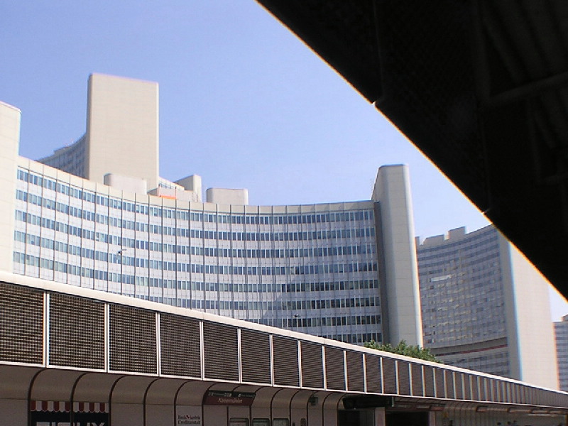
A bécsi ENSZ Központ, a COPUOS székhelye. Kép: HUNAGI fotógyüjtemény, 2006
Magyar szakembert választottak az ENSZ Világűr-bizottsága első alelnökének


Az ENSZ Világűrbizottságának (UN COPUOS - Committee on Peaceful Uses of Outer Space) idei ülésszakán mint COPUOS-tagállam, Magyarország is jelen volt. Az ülés kezdetén a küldöttek megválasztották a Világűrbizottság tisztségviselőit a 2006-2007-es évekre. A hazai űrkutatás komoly elismerésként tekinthető, hogy a MŰI igazgatóját az ENSZ Világűrbizottságának első alelnökévé választották. A MŰI a HUNAGI alapító szervezete. Gratulálunk dr. Both Előd úrnak magas tisztségéhez! A dr. Lothar Beckel vezette szekcióülésen dr. Csató Éva, a FÖMI Távérzékelési Központ tudományos főmunkatársa előadást tartott erdészeti alkalmazások témakörében.
Mint arról márciusi naplóbejegyzésünkben (
http://hunagi.blogspot.com ) beszámoltunk róla, Lothar Beckel iskolai űratlasza a német mellett magyar nyelven jelent meg először Európában. A magyar változat elkészítésében közreműködő magyar szervezetek mindegyike a HUNAGI tagja.
Bővebbet a MŰI honlapján:
www.hso.hu