2007-02-20

Fotogrammetriai nagydíjra jelölési lehetőség


Carl Pulfrich Díj
Az ISPRS főtitkára írta mai levelében:

"Friends,
Please read the document about the Carl Pulfrich Award Applications
carefully and send the applications with the requested information to the address given in the document.
Regards,
Prof. Dr. Orhan Altan
Secretary General of ISPRS
Headquarters of the Society
Ist. Tech. Univ.; Fac.of Civil Eng.
Division of Photogrammetry
34469 Ayazaga-Istanbul/Turkey
Tel; +90 212 285 3810; Fax; +90 212 285 6587 "

Jelölést ezen a csatornán az ISPRS magyar tagszervezete, a Magyar Földmérési, Térképészeti és Távérzékelési Társaság adhat. Az elolvasandó itt található:
http://www.fomi.hu/hunagi/pdf/2004/CP.pdf
További kapcsolatos leírás:
http://www.rspsoc.org/news/intergraph-announces-2007-carl-pulfrich-award-program/

Az ISPRS Magyar Nemzeti Bizottság honlapoldala: www.isprs.hu
ISPRS: www.isprs.org
AGILE: www.agile-online.org
EuroSDR: www.eurosdr.org
NKTH: www.nkth.gov.hu

2007-02-17

International 3D Contest sponsored by Google, ESRI, NASA and others


Felhívás az oktatóhelyek és akadémiai intézmények számára: innovatív 3D megjelenítési pályázat az 5. Digitális Föld konferencia alkalmából

A HUNAGI mai postájából:

"Dear University Colleagues,
An unprecedented International Digital Earth 3D Visualization contest has been launched, under sponsorship of Google, NASA, ESRI, and other technology leaders. This international contest will seek to discover the best examples of visualizing the challenging issues involved in bridging science to public understanding, policy, and action.
Please find contest rules and entry form at:
http://www.isde5.org/grandchallenge
We would sincerely appreciate if you would share the attached poster and information above to your colleagues and students. Six winners will be flown to UC Berkeley for the 5th International Symposium on Digital Earth where they will experience a life-changing opportunity to debut their work and be recognized as the bright stars of our future.
Thank you for your support of this time-sensitive Grand Challenge.
Please send all inquiries to
info@isde5.org
Dr. Timothy W. Foresman,
Director-General, 5th International Symposium on Digital Earth "
-------
AGILE: www.agile-online.org
EuroSDR:
www.eurosdr.org
NKTH:
www.nkth.gov.hu
Int.Journal on SDI Research: http://ijsdir.jrc.it

2007-02-07

Digitális Föld Csereprogram (DEX) pályázati felhívás


Az első évente meghírdetésre kerülő nemzetközi Digitális Föld Diákverseny


"Student Competition + Scholarship.
A requisite step in addressing the future of Digital Earth is to invest in the next generation’s educational foundations for harnessing advanced technologies and applications. In meeting this objective, the Secretariat of the 5th International Symposium on Digital Earth has launched a collective set of seminal activities that will help stimulate and promote the prowess of Digital Earth among a wide variety of campuses across North America and internationally. The following components comprise the comprehensive strategy to provide the necessary tools, internet architecture, and incentives for university students to actively participate over the months leading to
First Annual International Digital Earth Student Competition.

Digital Earth Exchange (DEX) – A network of supercomputers, led by the Japanese Earth Simulator (the world’s largest computer) and the San Diego Supercomputer, led by the Visualization Center of San Diego State University form a backbone for the operation of multiple “geobrowsers” and the appropriate resources of large area geo-referenced data sets. Protocols and established documentation procedures are being developed in conjunction with the Electronic Cultural Atlas Initiative led by UC Berkeley and the Digital Alexandria project led by UC Santa Barbara. This Digital Earth Exchange network will function as the repository and server operations center for the performance of geobrowser tessellation engines, including NASA’s World Wind, GeoFusion GeoMatrix Toolbox, and other commercial “digital earths.” This will enable thin-client performance via the network and public access to the information and computational resources.Digital Earth Reference Model (DERM) – A reference model has been resurrected from the Federal Geospatial Data Committee and ISO communities in collaboration with the original NASA led Interagency Working Group on Digital Earth. The DERM is currently being handled by a coalition of open-system developers including the Open Geo and Open Geospatial Consortium. This standard reference model will enable researchers and students to quickly access the most advanced set of standards and protocols for development and operation of advanced technological systems and applications. The DERM coordination is being led by Dr. Charles Herring.Rules for the Scholarships & Competitions - Beginning on the 1st of November, 2006, specifications for the Competitions and Scholarships will be promulgated to a core of set of universities and their community networks who will be invited to apply for Digital Earth Scholarships in the form of selected student licenses for the Digital Earth tessellation engines (currently available for GeoFusion’s GeoMatrix Toolkit and NASA World Wind) for the university research projects. This license access, under supervision of the professors, will place valuable technical software resource tools into the hands of creative and progressive intellectual leaders among the student population. Students will be required to demonstrate either (1) advances in the performance or attributes of the 3-D tessellation engines or demonstrate an (2) application (i.e., Earth science, climate change, social, humanitarian, et cetera) portraying creativity and excellence in visualizing and communication of a thematic topic. The student demonstrations must be submitted into the Digital Earth Exchange (details on these specifications to be announced asap) by 1 April 2007 for consideration by the judges. Student winners will be notified by 1 May to arrange for travel to the 5th International Symposium on Digital Earth event in San Francisco to receive their prizes.
Coordinators for the Student Competitions and Scholarships for the ISDE5 Secretariat are Professor Nick Faust (Space Technology Hall of Fame (1993)) and Chuck Stein (Vice President of GeoFusion)."
Source: www.isde5.org
More on AGILE: www.agile-online.org
More on EuroSDR: www.eurosdr.org
More on
More on NKTH: www.nkth.gov.hu

2006-08-16

Az EU Egyesített Kutatóközpontja új térinformatikai részlege

b: Az Egyesített Kutatóközpont az olaszországi Isprában
j: EU-s csatlakozásunk évében Alessandro Annoni az újtagországok képviselői részére ismertetést ad az INSPIRE kezdeményezésről Kép: (c) HUNAGI fotógyüjtemény, 2004


Az Európai Bizottság Egyesített Kutatóközpontjában Téradat-infrastruktúra (SDI) egységet létesítettek

2006 január 1-jévellétrehozottúj szervezeti egység feladata egyrészt az INSPIRE kezdeményezés műszaki koordinációja, másrészt az Európai Téradat-infrastruktúra (ESDI) megvalósításához vezető sokféle megteendő lépések felügyelete. Mind a Bizottságon belül, mind a tag- és tagjelölt országokban az SDI egyfajta kapacitás építéssel az intézményfejlesztést állítja a homloktérbe.
Mindezek a tevékenységek az 5. Keretprogramban keretében végzett sikeres munka folytatásának tekintendők, mely során az Egyesített Kutatóközpont részlege az Európai Bizottság Földrajzi Információs Műszaki Irodájaként működik. Munkáját összehangolja az EU intézmények térinformatikai alkalmazási (COGI, GISCO) programjaival, támogatja a térinformatikához kötődő szabványmeghatározásokat és bevezetésüket, a műszaki fejlesztések nyomon követését, valamint biztosítja a kapcsolódó információnak mind az Európai közösséghez juttatását internetes portálon keresztül (EC GI-GIS web portal), mind az Európai Bizottság évente megrendezésre kerülő műhelye, az (EC GI-GIS workshop) előadásköteteivel.

Európát országai foltvarrásszerűen alkotják mind megannyi eltérő hagyománnyal és megoldással. Egy közös infrastruktúra megépítése nem lehetséges az adatharmonizáció és a szemantikus interoperabilitás megkerülésével. Ez a munka olyan kutatási tevékenységet is feltételez, amely a téradatok fúzióját generalizálását és a szolgáltatások egymás közötti működőképességét (interoperabilitását) segíti elő, de figyelmet fordít a tagországok kapacitás-növelésére képzésen, oktatáson és fogadókészség-növelő akciókon keresztül, összekötő kapocsként szolgálva az európai és nemzetközi kutatói közösségek, hálózatok és kezdeményezések (pld. a nemzeti téradat infrastruktúrák) között, támogatva egyuttal a GMES programot is.
Az EU új tagországai aktív résztvevői az INSPIRE munkacsoportoknak de külön akcióprogram indítanak benne külön műhelyekkel a figyelemfelkeltés és a további kapacitásbővítés céljából.

Az új egység fő célkitűzései a
- az INSPIRE kezdeményezés műszaki koordinációjának biztosítása az Európai Bizottság és a tagországok között, lehetővé téve a műszaki összetartozást és az információcserét az INSPIRE munkacsoportok között,
-Földrajzi Információ Műszaki Iroda gyanánt működve tudományos és műszaki támogatást biztosítson az Európai Bizottság számára, amely magában foglalja az összekötő kapcsot mind belül (COGI, GISCO, GMES) , mind kívül (az EU-n kívüli nemzetközi tudományos közösség irányában a térinformatikai szabványosítási kezdeményezésekkel, továbbá a képzésben és az ismeretek terjesztésében,
- támogassa az Egyesített Kutatóközpont Környezeti és Fenntarthatósági Intézetében (IES) folyó pan-európai téradatbázisok fejlesztését és a kapcsolódó üzemszerű térbeli információs szolgáltatásokat a Forest, Natura2000, Image2000 és az Európai Területi Tervezési Megfigyelő Hálózat (ESPON) más kiemelt alkalmazási programjai támogatására,
- képzés és utaztatás.

Magyarországon az INSPIRE kezdeményezéssel összefüggő figyelemfelketésben a HUNAGI aktív és kezdeményező szerepet játszik és az elsőhelyi kormányzati felelősőkkel együttműködve 2002 óta törekszik a hazai fogadókészség erősítésére. Ennek legutóbbi példája volt a június 30-i INSPIRE Információs Nap a FÖMI-ben, és ezt követi reményeink szerint a november 15-i INSPIRE Nemzeti Nap, amelynek szervezése már az Európai Bizottság Egyesített Kutatóközpontja Téradat-infrastruktúra egysége segítségével és módszertani támogatásával folyamatban van. A HUNAGI 2005 óta a DG JRC nyilvántartott SDIC partnere.
SDIC: a téradatok előállításában, forgalmazásában, fejlesztésében és használatában érdekelt szervezetek közössége. Egy másik kategória az LMO, a felsorolt működési területek bármelyikén vagy mindegyikén jogszabály által felruházva működő szervezet. A JRC IES SDI által nyilvántartott hazai szervezet a FÖMI és az OMSz, de más intézmények bejelentkezésére is mód van.

Források:
A DG JRC SDI legutóbbi (aug 14-i) HUNAGI-nak címzett levele,
http://inspire.jrc.it
http://sdi.jrc.it
http://www.espon.eu
http://www.ec-gis.org/cogi
http://projects-2006.jrc.cec.eu.int/show.gx?Object.object_id=PROJECTS000000000200D85B;
http://projects-2006.jrc.cec.eu.int/show.gx?Object.object_id=PROJECTS000000000200EEB6;

2006-08-15

Konferencia a térinformatika elméleti hátteréről

A térbeli információ elmélete - Rendezvény a Melbourne-i Egyetemen

COSIT'07: Ninth International Conference on Spatial Information Theory

Időpont: 2007 szeptember 19-23
Helyszín: Mt Eliza, Melbourne, Ausztrália

Elnökök: Stephan Winter (U Melbourne), Benjamin Kuipers (U Texas)Local
Társelnökök: Matt Duckham (U Melbourne) , Lars Kulik (U Melbourne)
Doktori kollokvium vezetője: Alexander Klippel (U Melbourne)

Előzetes felhívás: itt

A COSIT konferenciaköteteit a Springer a Lecture Notes in Computer Science elnevezésű sorozatában adja ki.


COSIT '03: Kuhn, W., Worboys, M. and Timpf, S. (Eds.). (2003). Spatial information theory: Foundations of Geographic Information Science (Lecture Notes in Computer Science 2825). Berlin: Springer. ISBN 3-540-20148-3, available online here.
COSIT '01: Montello, D.R. (Ed.). (2001). Spatial information theory: Foundations of Geographic Information Science (Lecture Notes in Computer Science 2205). Berlin: Springer. ISBN 3-540-42613-2
COSIT '99: Freksa, C., and Mark, D. M. (Eds.). (1999). Spatial information theory: Cognitive and computational foundations of geographic information science (Lecture Notes in Computer Science 1661). Berlin: Springer. ISBN 3-540-66365-7
COSIT '97: Hirtle, S. C., and Frank, A. U. (1997). Spatial information theory: A theoretical basis for GIS (Lecture Notes in Computer Science 1329). Berlin: Springer. ISBN 3-540-63623-4
COSIT '95: Frank, A. U., and Kuhn, W. (1995). Spatial information theory: A theoretical basis for GIS (Lecture Notes in Computer Science 988). Berlin: Springer. ISBN 3-540-60392-1
COSIT '93: Frank, A. U., and Campari, I. (1993). Spatial information theory: A theoretical basis for GIS (Lecture Notes in Computer Science 716). Berlin: Springer. ISBN 3-540-57207-4
COSIT "0": Frank, A. U., Campari, I., and Formentini, U. (1992). Theories and methods of spatio-temporal reasoning in geographic space (Lecture Notes in Computer Science 639). Berlin: Springer. ISBN 3-540-55966-3


Az újabban kiadott előadáskötetek és cikkek on-line is elérhetők a Springer weblapjáról: SpringerLink Lecture Notes in Computer Science .


Bővebb rendezvénynaptár a www.hunagi.hu News... Recommended Events..2007... alfejezetében.

2006-07-19

A magyar űrkutatás elismerése az ENSZ-ben

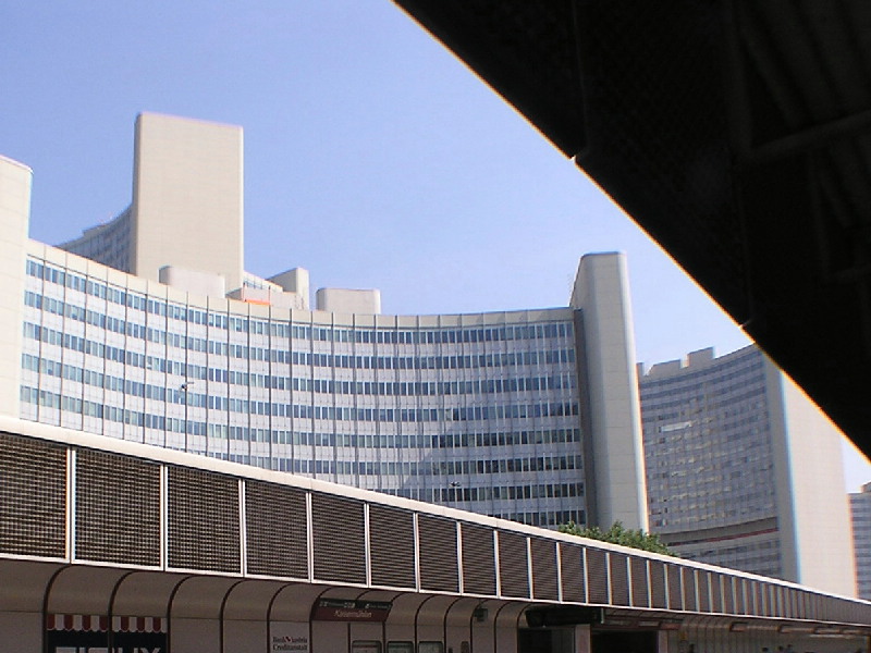
A bécsi ENSZ Központ, a COPUOS székhelye. Kép: HUNAGI fotógyüjtemény, 2006
Magyar szakembert választottak az ENSZ Világűr-bizottsága első alelnökének


Az ENSZ Világűrbizottságának (UN COPUOS - Committee on Peaceful Uses of Outer Space) idei ülésszakán mint COPUOS-tagállam, Magyarország is jelen volt. Az ülés kezdetén a küldöttek megválasztották a Világűrbizottság tisztségviselőit a 2006-2007-es évekre. A hazai űrkutatás komoly elismerésként tekinthető, hogy a MŰI igazgatóját az ENSZ Világűrbizottságának első alelnökévé választották. A MŰI a HUNAGI alapító szervezete. Gratulálunk dr. Both Előd úrnak magas tisztségéhez! A dr. Lothar Beckel vezette szekcióülésen dr. Csató Éva, a FÖMI Távérzékelési Központ tudományos főmunkatársa előadást tartott erdészeti alkalmazások témakörében.
Mint arról márciusi naplóbejegyzésünkben (
http://hunagi.blogspot.com ) beszámoltunk róla, Lothar Beckel iskolai űratlasza a német mellett magyar nyelven jelent meg először Európában. A magyar változat elkészítésében közreműködő magyar szervezetek mindegyike a HUNAGI tagja.
Bővebbet a MŰI honlapján:
www.hso.hu

2006-06-14

Internetes szakfolyóirat a térat-infrastrukturák kutatásáról / On-line Journal on SDR Research

International Journal on Spatial Data Infrastructures Research


Extract of the Call for Papers:
Articles are considered for publication in the following areas:
The Journal encourages articles from broad multi-disciplinary backgrounds including social and environmental sciences, and engineering, deploying also critical and interpretative methodologies. Articles in the following areas are particularly welcome:
Spatial and Network Technologies with particular emphasis on the development of geoinformation services, interoperability, technical specifications and standards, distributed geoprocessing and grid computing, sensor webs, intelligent (geo)agents, and related areas. Reflections on the next generation of SDIs, their components, and research challenges that need addressing to develop them are encouraged.
Distributed Spatial databases and metadata with particular emphasis on data harmonization, conceptual modeling and schema mapping, semantics, ontologies, data quality and uncertainty, and innovative ways of documenting, indexing, searching and retrieving information resources in multi-lingual/cultural and multi-disciplinary settings.
Methods for data mining and knowledge retrieval, feature extraction, data fusion, integration, generalization, and visualization in distributed environments, and to spatial analysis, modeling, and simulation in environmental and social policy domains.
Information Policies with particular attention paid to the impacts of different policies and business models for data acquisition, documentation and maintenance, access, and exploitation. Articles reflecting on the differential impacts of such policies on data producers, value added resellers and business, education and research, and end-users at different levels, from trans-national to local, are encouraged, as well as articles on the organizational and institutional challenges to SDI implementation.
Applications and Impacts of SDIs at local, regional, national, and trans-national levels in different environmental and social policy thematic domains. Articles on applications are encouraged to be more than a mere description, but to provide a critical reflection on the underlying drivers, of what seemed to work and what did not. Analyses of failures are also welcomed as there is much to learn from these experiences. The Journal intends to pay particular attention to the social and economic impacts of SDIs, and related Information Infrastructures (e.g. e-government) at organizational, inter-organizational, and territorial levels. Studies on cost-benefits and return on investment are especially welcomed as well as evidence of positive or negative impacts on and for communities (virtual or physical) in respect to their development, mobilization, participation and empowerment.


Editor
M. Craglia

European CommissionDG Joint Research CentreInstitute for Environment and SustainabilitySpatial Data Infrastructures UnitT.P. 262Via Fermi 120120 Ispra (VA)ItalyE-mail: Massimo.Craglia@jrc.it
JRC Editorial Board
Massimo Craglia

Lars Bernard
Paul Smits
Pierre Soille
Editorial Advisory Board
M. Blakemore, University of Durham
M.M. Brown, University of North Carolina at Chapel Hill
Z. Nedovic-Budic, University of Illinois at Urbana-Champaign
N. Chrisman, University of Laval
D. Coleman, University of New Brunswick
J.P. Donnay, Université de Liège
Y. Georgiadou, ITC, Enschede
M. Goodchild, University of California at Santa Barbara
M. Gould, Universitat Jaume I, Castelló
J. Jiang, National Geomatics Center of China
W. Kuhn, University of Münster
I. Masser, University College London
H. Onsrud, University of Maine
G. Remetey-Fullop, Hungarian Association for Geo-Information
I. Williamson, University of Melbourne

Bővebbet:
http://ijsdir.jrc.it/

More on AGILE: www.agile-online.org
More on EuroSDR:
www.eurosdr.org
More on NKTH:
www.nkth.gov.hu

2006-06-12

ISPRS alap tudományos kezdeményezések felkarolására


ISPRS logo Kép: HUNAGI fotógyüjtemény

ISPRS alap tudományos kezdemé-nyezések támogatá-sára

A munkacsoport-vezetők javaslata alapján a műszaki bizottságvezetők ajánlatára fognak dönteni az odaitélésről a goai konferencián.
Magyarországnak egy munkacsoport társvezetője van, éppen a Téradat-infrastruktúra témakörben.
Az ISPRS magyarországi tagszervezete az MFTTT (
www.mfttt.hu).
Az ISPRS Magyar Nemzeti Bizottság elnöke Winkler Péter.

More on AGILE: www.agile-online.org
More on EuroSDR:
www.eurosdr.org
More on ISPRS:
www.isprs.org

2006-06-10

3D visualisation - the HoloVizio approach


Illustration: extracted from Holografika Ltd's homepage

Hungarian solution for 3D Display: the HoloVizio


Holografika Kft has been nominated in the IT category of the World Economic Forum's "Technology Pioneers 2006 and has business success at the recent Research and Innovation Exhibition in Paris.

The 3DCGI.com writes on the HoloVizio approach of the Hungarian Company Holografika:

"The feature list for the HoloVizio line of displays is impressive. Like most of the displays mentioned here HoloVizio boasts true 3D with the naked eye. But, it's the other features that stand out.
- Viewers can walk around the screen in a wide field of view seeing the objects and shadows moving continuously as in the normal perspective. It is even possible to look behind the objects, hidden details appear, while others disappear (motion parallax)
- Unlimited number of viewers can see simultaneously the same 3D scene on the screen, with the possibility of seeing different details
- Objects appear behind or even in front of the screen like on holograms
- No positioning or head tracking applied
The displays are currently available in 32" (16:9) and 26" (4:3) sizes. "

More on the different 3D visualisation solutions:
http://www.3dcgi.com/cooltech/displays/displays.htm


More on Holografika:
www.holografika.com
More on HUNAGI:
www.hunagi.hu
More on NKTH:
www.nkth.gov.hu

2006-05-22

2. Európai kutatás és innováció kiállítás Párizsban

Paris Expo Porte de Versailles. Image: archiguide.free.fr/ PH/FRA/Par/P15PExpoVaPi.jpg

Második Európai Kutatás és Innováció Kiállítás


Lippényi Tivadar (NKTH alelnök www.nkth.gov.hu ) a közintémények és a magánszféra együttműködéséről a kutatás és innováció területén
http://www.salon-de-la-recherche.com/2/conference/56-public-–-prive-:-un-ticket-gagnant-pour-la-recherche-et-l-innovation.html
Helyszín: Paris Expo 7.2 csarnok
Időpont: 2006 június 8-11
Érdeklődés: www.salon-de-la-recherche.com
Eddigi több mint 100 kiállító között vannak:
CNES, Cordis, ESA, IFREMER, INRA, CNRS, Géosciences, Ambassade de Hongrie

Forráshelyek: térinformatika, tudomány, kutatás és innováció témakörökben

Folyamatos bővítés alatt, kiegészítési javaslatot az olvasóktól is várunk!

CORDIS focus szaklap
http://cordis.europa.eu
http://cordis.europa.eu.int

European Innovation szaklap
Bővebbet: http://www.europa.eu/comm/enterprise/innovation

Association of GI Laboratories in Europe (AGILE)
Bővebbet: www.agile-online.org

European Spatial Data Research (EuroSDR)
Bővebbet: www.eurosdr.org

Nemzeti Kutatás-Fejlesztési Hivatal (NKTH)
Bővebbet: www.nkth.gov.hu

2006-05-04

HAS Geodetic Scientific Committee Meeting on GNSS infrastructure development


Chaired by Dr. József Závoti, the subject was introduced by Co-chair Dr. Szabolcs Mihály. Image: HUNAGI Visual Resources


It is anticipated, the GNSS infrastructure development will be accelerated in order to achieve full country coverage


More news on actions will be available soon

2006-04-21

NT -11 Térinformatika, tudomány, kutatás és innováció

NTIS -11 Témakör:

A térinformatika tudományos kérdéseivel, a kapcsolatos kutatásokkal és innovatív megoldásokkal kapcsolatos nyílt fórum.

Információforrásai különösen
1) az AGILE (Európai térinformatikai laboratóriumok társulása,
http://www.agile-online.org ) és az EuroSDR (a téradatokkal kapcsolatos kutatások európai szervezete, http://www.eurosdr.net ) szakmai anyagai, hírei,
2) az Egyesült Államok térinformatika tudományos kérdéseivel foglalkozó szervezetek pld. UCGIS http://www.ucgis.org/ anyagai,
3) A napjainkban induló DG JRC SDI Research on-line folyóirat követése recenziókkal (szerkesztőbizottságába HUNAGI tisztségviselő is meghívást kapott). Egyelőre a források: http://www.giscience.org , http://gi-gis.jrc.it/ws/BeyondSDI/
4) a hazai kutatási és innovációs programok hírei, eseményei


Felkért Társszerkesztők:

Dr. Barsi Árpád
tanszékvezető, BMKE
Fotogrammetriai és Térinformatikai Tanszék
Tel: 463-1186
e-posta: barsi@eik.bme.hu